
Roke Exploration Navigation System (RENS)
Roke Exploration Navigation System (RENS) is an inertial navigation system which helps you navigate confidently in buildings, tunnels, and underground environments where GPS fails. Keep your operations moving with Roke Exploration Navigation System (RENS), a proven computer vision tool that delivers accurate positioning and orientation data using only a camera and sensors.
Maintain Positioning, Navigation and Timing (PNT) capability in GPS-denied/intermittent environments using advanced computer vision and sensor fusion. RENS is an inertial navigation system helping to track your position and orientation in real-time through buildings, tunnels, and underground spaces.
Passive Navigation Without Satellites
Operations often require navigation in GPS-denied environments like buildings, tunnels, underground facilities, and urban canyons, which block satellite signals, leaving personnel and unmanned systems without reliable positioning.
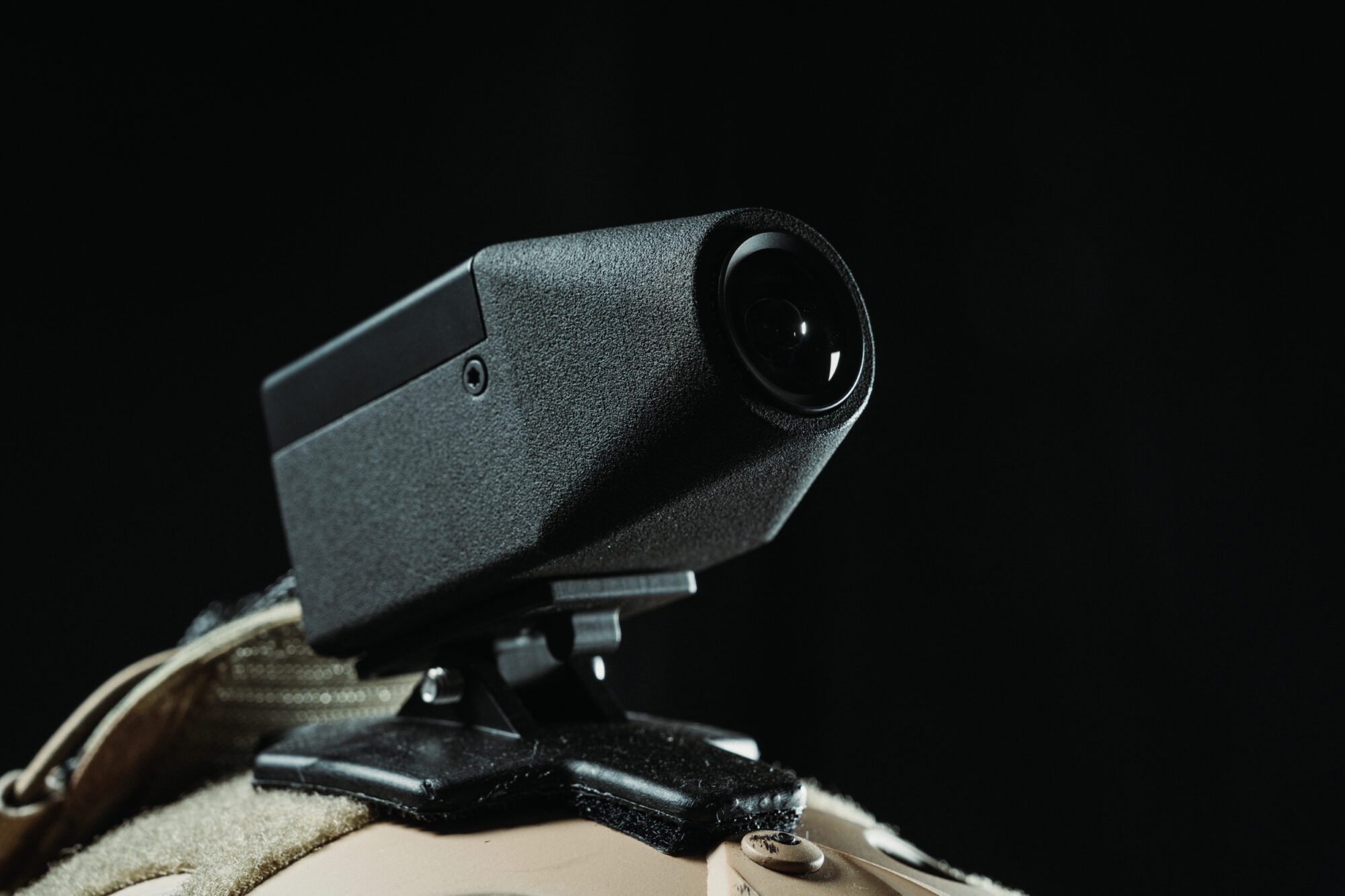
RENS is an inertial navigation system that helps solve this using computer vision algorithms that track movement through any environment. A single camera, inertial sensors, and processing unit create accurate position estimates without external signals. Deploy on personnel or integrate with unmanned systems for continuous navigation capability.
Achieve sub-4% drift rates over distances up to 2km during hour-long missions. Maintain operational effectiveness when GPS jammers activate or environmental conditions block satellite access.
How RENS benefits you
-
Navigate without satellites
Track position and orientation in buildings, tunnels, and underground environments.
-
Real-time positioning
Generate position estimates at 10Hz for immediate tactical awareness.
-
Lightweight and compact
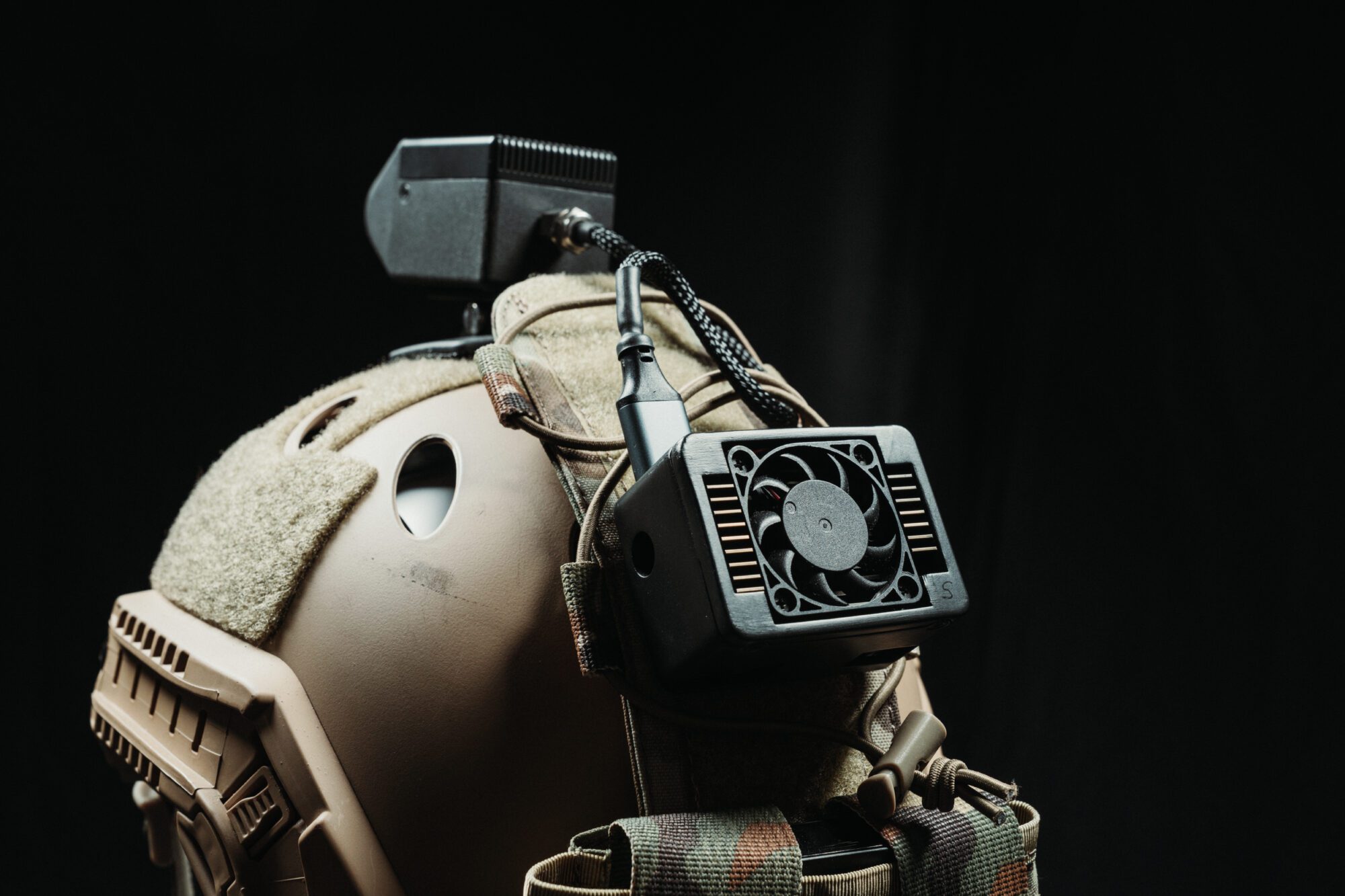
Deploy minimal hardware using commercial components with swappable power supplies.
-
Proven performance
Achieve average 2.4% drift rates in tunnel environments during extended operations on human based trials.
Flexible Integration Options
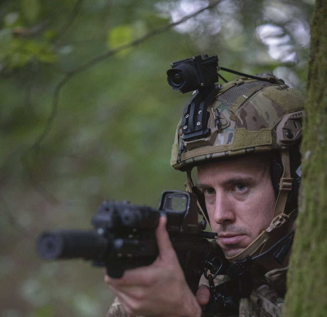
RENS integrates with existing tactical systems including ATAK displays and CC1 devices. Deploy as helmet-mounted tactical sensor or as part of vehicle-integrated system using commercial off-the-shelf hardware for cost-effective inertial navigation solutions.
RENS FAQS
RENS inertial navigation system maintains sub-4% drift over 2km during hour-long indoor operations.
Just a single camera, an Inertial Measurement Unit (IMU) sensor, and small Raspberry Pi processor using standard commercial hardware.
Yes, Android apps are available that integrate with ATAK displays and other tactical platforms like the CC1 tactical smartphone.
Swappable batteries enable extended missions with multiple power options.
Yes, RENS can be used on unmanned vehicles for GPS-denied operations. Performance would be dependent on the existing platform sensors and processing specifications.
No, RENS enables navigation in completely unmapped environments.
Real-time positioning at 10Hz for immediate tactical awareness.
Any GPS-denied indoor environment with visual features, including buildings, tunnels, and underground facilities.
Yes, ranging from space models to fully functioning systems, primarily for human wearable and limited vehicle evaluation.
The utilised camera with NIR sensitivity allows for low light level navigation but is also optimised for active IR illumination recommended for extremely low light levels.
Sectors that use RENS


Need Clarity, Pace or a Fresh Perspective?
If you’re facing a challenge that needs clarity, speed or a different kind of thinking – let’s talk. We’ll connect you with the right people to get things moving.